Jungle Mapping
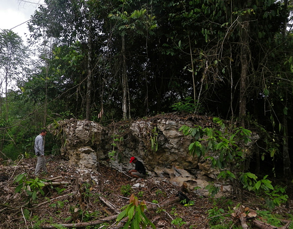
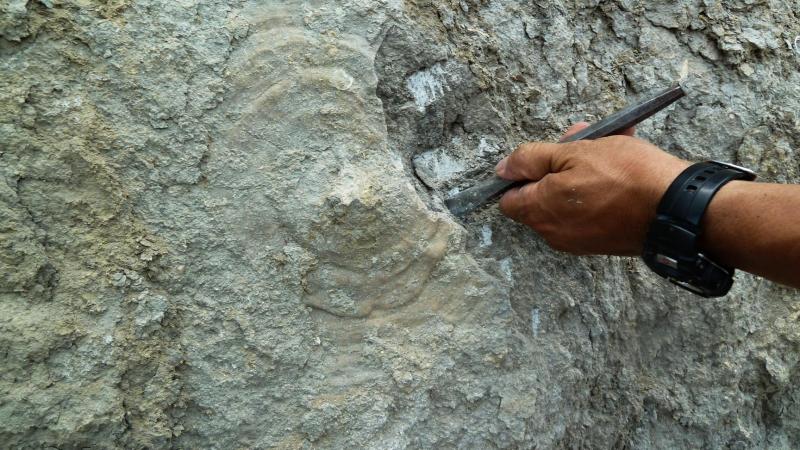
The outcrops can't always be as nice as in Samarinda. Vibor and Alex map out limestone patches in the Jungle near Tanjung Redeb while sampling for biostratigraphy.
The outcrops can't always be as nice as in Samarinda. Vibor and Alex map out limestone patches in the Jungle near Tanjung Redeb while sampling for biostratigraphy.

For those of you thinking we are payed to go to Indonesia
and enjoy tropical beaches walking around occasionaly looking for fossils, I
will try to describe our working day. Place of action: Talisayan, little
village in the middle of the Mankalihat northern coast.
06:30 Wake up, using lovely common facilities (no toilet,
shower, or tap water in the room).
07:00 Breakfast in the nearby restaurant.
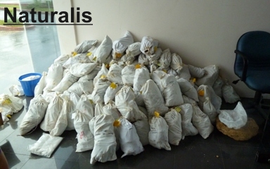
Today was a rainy day in Bontang, the base camp. Luckily, we
had decided to stay at the hotel to organize the samples and fill out the spreadsheets. Only one week of duties and we have already collected about
270 sample bags!! Look at the piles for yourselves... and just imagine the
amount of work we have in front.

By Anja Roesler.
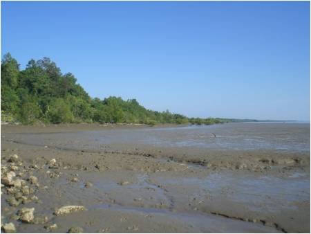
The last two
days of the carbonate team who are Vibor, Simone, Juan Carlos, Anja and Dedy
were spent on a long cliff section of mainly marly and very weathered limestone.
That was not that much of a scientific pleasure, but this is also part of
fieldwork. This section was finished today at the side of an impressively huge
mudflat (pic. 1), near the “buaia buaia” what means Crocodile River.

This shady creek section might contain the Eocene/Oligocene boundary, which is rare a rare and important find if true.
To perform transects on the coral assemblages of the Top-reef
Stadion (TF51 & TF57).
![]()
![]()
 On the 22nd June, the group conformed by Paul,
Emanuela, Nadia, Pak Untug, and Aseb settled in Samarinda. Soon after lunch, we
went back to Batu Putih (TF76) to have a look on the corals and looking for
bryozoans. Although an active quarry, the outcrop has not changed that much
from last year. Intact colonies of platy corals were observed upside down, and this
time we tried to collect the ones we left behind from last year, but again...
 These thick coal beds lie within Middle Miocene (? according to Witts et all 2011, IPA Proceedings) Warukin Formation in the Barito Basin. Not all coals are this thick . . . today we logged a section that included a 1 m thick coal overlain by a marine transgressive mud with abundant small aragonitic molluscs. The fauna was dominated by protobranch bivalves typical of very fine grained organic-rich marine muds. Sorry, no seagrasses here (yet).
Greetings from the Barito Basin! Aries, Ken and Jon followed Verbeek’s original (1875) geological map overlain onto Google Earth to find the Pengaron locality, from which a great fauna of corals and poorer molluscs was originally described. Just at the right point on the map – a river bank section - we found a thin series (4m) of massive, hard, bioclastic limestones and sands with corals, molluscs, algal balls, a shark tooth and vertebrate material abruptly and concordantly overlying thin-bedded silty mudstones.